Gladstone, Queensland – the placement continues

So i arrived in Gladstone In December, a little while after i had originally planned, and was greeted at he airport by my supervisor Sarah. It was so nice to see her again and to be back on the project. After a whistle stop tour through town and some much needed food, Sarah took me the her university (Central Queensland University) where i met some of her fellow PhD students, CQU staff and also her supervisor Owen. I was lucky enough to find some accommodation with a lovely couple, one of which worked at the university. I met Mary that same day and she took me back the their house where i was to be spending the next 2 months.

View from my bedroom window

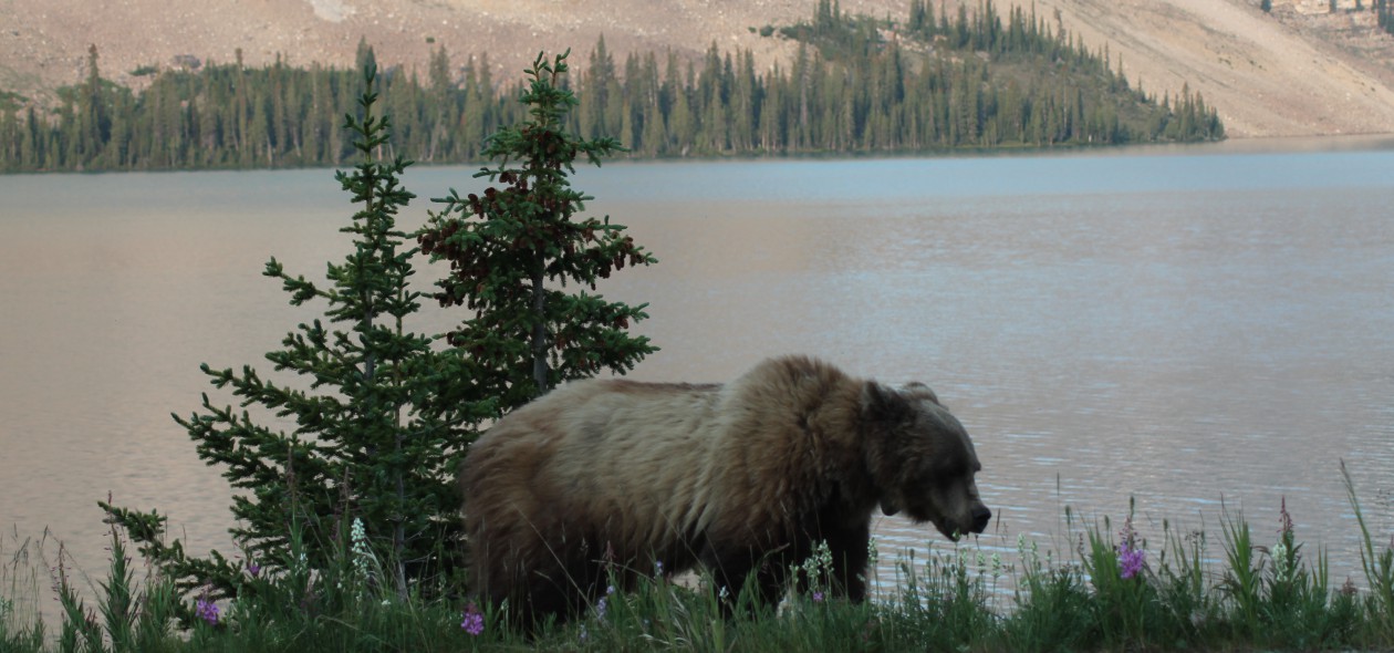
I really lucked out, the house was beautiful and Mary and Adrian were awesome to live with. The next day was when the work began. So my job for the first few weeks was to analyse some of the thousands of images that were still to be analysed. This job sounds like it would take no time at all, but from previous posts i assure you it does not. Each image has to be analysed to state how many individuals are in the image; that is then split into how many people, dogs, horses or Grizzly bears are in each images; what species is in the image (hiker, bike rider, horse rider, runner, Grizzly Bear or unknown bear); which direction the subject was moving in; whether the image is to be exported (if there is an image of a Grizzly Bear or a clear photo of another carnivore); and finally whether the images were consecutive or not. So as you can imagine, having to do this on every image with a subject in it was very time consuming.

Timelapse program
Timelapse program

As well as data entry, i was checking emails and liaising with volunteers that were still working on images back in Canada, making sure that they were getting on OK and saving any completed image folders to the appropriate place. A couple of weeks into the placement Sarah gave me a little more challenging job where i was to help clean the data that was analysed.

So here is a quick explanation of how/why we cleaned the data; When the analysed data is sent to us, it is automatically laid out in an excel sheet. My job was to combine all the folders from each trail network. For example Cascade Amphitheater was split into 5 excel sheets; CAA1 – 5. I needed to combine all 5 spread sheets into 1 master spreadsheet called Cascade Amphitheater. I then needed to find all the images that had been sent for export and make a note to find the images at a later date. All the blank photos needed to be deleted from the spreadsheets as well as the time and date being checked. Using a number of complex formulas (which Sarah had already created) some of the data had to be combined to generate totals for statistics. It was pretty complicated so i wont bore you with too many details. But once i got the hand of it i was on a roll.

So this is what i was working on for my 2 months in Gladstone, i assure you it wasn’t all work though. I had a great time and learnt a lot about data gathering/cleaning and also statistics (which is definitely not my strong suit).

It was quickly dawning on me that it was nearly time to go back home. After being so home sick for so long i was now at a place where i would have been happy to stay out there for another good few months. But all good things have to come to an end, and lucky for me i was having a pit stop in Sydney before home….

Living it up in Australia before the hard work begins!

So my gallivanting in Australia didn’t really go to plan. So as few of you may know I was having a few issues with my visa. This meant that instead of heading straight to Gladstone to finish the last 8 weeks of my placement and then travel from Gladstone down to Sydney, I had to travel around first and then head to Gladstone. My time had shortened dramatically and I only had just over 2 weeks to see as much of Australia as I could before starting back on the project, EEEK!

I flew into Brisbane at the end of November and spent my first few days here. On the first day I was there, I met up with Faye, a volunteer who helped out on the project in Canada, and we decided to go to the Lonely Pine Koala Sanctuary. This place was so cool. It must have been close to 30 degrees that day, heat that I certainly was not used too! We made our way there via bus and when we arrived we were pleasantly surprised as there were so many animals there as well as Koalas. We say bats, platypus, dingo’s, kangaroos and loads of different species of birds. I was so happy to cuddle a koala. They are so cute! And we also got to hand feed kangaroos.

IMG_5847 IMG_5853 IMG_5867 IMG_5916 IMG_5932 IMG_5943 IMG_5956 10404398_10152933182569855_3364438509855298150_n

After the koala sanctuary we headed back into Brisbane for a spot of sight-seeing then before we knew it it was time for Faye to go home.

IMG_5962 IMG_5979

We started making out way back to the train station when the heavens opened. It went from glorious sunshine to torrential rain in a matter of seconds! We carried on making our way to the train station and we were soaked. It was raining that hard we decided to take cover in a stairwell when the weather turned really nasty. The wind was so strong and now it was haling hail stones the size of tennis balls! We couldn’t believe it, what started out being a really funny ‘let’s ruin in the rain’ turned out to be a really scary experience. I can’t remember how long it lasted for. But when the hail started to let up we made our way to the train station to find that all the trains had been suspended due to the weather.

10556416_10154912599660370_8344195731923464157_n 10624762_10154912599075370_2970786177131262580_n 10689652_10154912601245370_2472151402173653687_n

Faye had to wait for hours before she could get home! Went I got back to the hostel the whole place had flooded, windows were cracked from the hail stones and the place was crazy! I found out the next day that it was a cyclone! What a first day!!

Over the next few days I didn’t do too much, just chilled out at the hostel and wandered around the town a little. Mainly trying to decide where to go next! I met a girl in the hostel who said I had to go to Byron Bay and stay at the Arts Factory (an old hippy commune). So I got it all booked up and off I went to Byron bay.

10802057_10154912604430370_1661695112769643071_n 1897933_10154912604905370_5080755079948403656_n 10402719_10154912605220370_767938155036755618_n 10802057_10154912605510370_3990746808867787288_n

I think Byron has to be my favourite place that I visited. It is so chilled out and crazy at the same time. The hostel was amazing; I was staying in a lakeside dorm, a 10 bed female dorm which was situated right next to the lake.

10426528_10154912603100370_1935039014774239084_n 10612706_10154912606080370_871322353473862195_n

In the morning I did a spot of guided meditation by the lake then had a massage, not a bad way to start the day eh?

10592622_10154912603370370_6015899887518867844_n

I decided to head into town to have a nosey around, then in the afternoon I met up with a lovely Scottish girl, Heather, who I had met in Brisbane and we went out for food and a few drinks. We decided to go Kayaking the next day, which was awesome.

10525972_736798259731903_5341384991010628717_n

I was a little hung over from the night before but still really enjoyed it. We saw sea turtles before stopping for a tea break at one of the beaches. When we got back in the water we were lucky enough to catch a glimpse of some dolphins. The paddle back to shore was horrendous. Seem like it took an eternity! So afterwards we had some well-deserved R&R at the beach.

This was my last day in Byron bay so me and a few of the girls from the hostel decided to go out for the night. We headed to a place called cheeky monkeys which served $5 meals and a free drink. It was awesome. The bar was crazy; they were giving away some mental prizes and played some mad games. It sure was an experience!

From Byron Bay I was catching a bus back to Brisbane and heading straight through to Rainbow beach where I was staying over for the 1 night ready for my Fraser Island trip! Everyone who I had spoken to told me I had to go, so I did! Even though it did cost me an arm and a leg! I had opted to go for the 3 day 2 night tour where we had a driver and stayed in a ‘wilderness cabin’. This was the most fun in 3 days I have ever had. I met some awesome people along the way too.

IMG_6007 IMG_6008

Here we swam in lakes…

IMG_6058 IMG_6083 IMG_6012 IMG_6004 IMG_5989 IMG_5986

went on hikes through the rain forest…

IMG_6015 IMG_6016 IMG_6028IMG_6014

Hiked up Indian head to see an awesome view…

IMG_6068

Saw snakes and dingoes….

IMG_6098 IMG_6093

Ate awesome food and had some of the bumpiest rides of my life in a big pink pimped up coach!…

1464631_10154934017485370_8022700428885837052_n

Saw a ship wreck…

IMG_6073

Oh and how could I forget that I FLEW IN A PLANE over the island? Could have been because I was a little hung-over but that flight sorted my head out fast, was incredible to see it from the air…

10848006_10154926865705370_4254355243819417412_n 150720_10154926865335370_6668738406267593563_n 1911667_10154926874545370_7567538142567201500_n 10848044_10154926868835370_1499214024537380323_n

It was great!

After Fraser Island it was back to Brisbane for a few days to chill out before heading to Gladstone. I met a couple of awesome girls, Clare and Michelle, and I think we just ate and drank our own body weight in food and beer! Good times.

10606071_10154934018105370_1646899983163687623_n 10624786_10154934941250370_8035531703440097890_n

Next stop, Gladstone……. 🙂

From Canada to the US

Again, it’s been a while since my last blog. That’s because I have been gallivanting in the USA and Australia before settling back into the project in Gladstone.

So before I go into the project, let me tell you a little about my gallivanting. Starting with USA…

From Canada I flew to LA where I was staying in Santa Monica. I had originally only booked 3 nights here as I wasn’t sure if I was going to stay or move on. It turns out that I loved Santa Monica, met some awesome people and stayed in a lovely hostel which was only 1 block from the beach and shops. I ended up staying here for a week, in which i spent my time visiting the beach, pier (where the end of the Route 66 sign is), went on a Malibu stars homes tour, visited Hollywood (here i did a tour of the lesser seen tourist attractions, walked along Hollywood Boulevard and went to see the Chinese theater), I also visited the LACMA art museum and the LaBrea tar pits. It was a whirl wind week. I ate amazing food, did a little more shopping than I probably should have and the sun sets from the beach where breath-taking.

3rd St Promenade
3rd St Promenade
The Santa Monica pier
End of Route 66 sign
Amazing sunset
Amazing sunset
View of LA from Hollywood
Start of the stars walk, Hollywood

IMG_5292

La Brea Tar Pits
La Brea Tar Pits
Beverly Hills
Beverly Hills

For an early birthday and Christmas treat, my parents paid for me to visit Hawaii for a week. This makes me sound very spoiled I know, and I am extremely grateful to them for this and this was most certainly a once in a lifetime opportunity.  And boy what a week it was. I was staying in a hostel that was half a block from the beach, 1 block from the zoo and minutes away from the shops. So of course on the first day, I visited the zoo. It was amazing, so many animals that I didn’t expect to see there.

Honolulu Zoo
Honolulu Zoo

IMG_5379 IMG_5397 IMG_5413 IMG_5430 IMG_5435 IMG_5457 IMG_5461 IMG_5476 IMG_5486 IMG_5537 IMG_5549

For a few days after I spent a lot of time relaxing on the beach, it was too hot to do much else and the sea was lovely to cool off in. Mid-week I did decide that I was doing too much relaxing so I went and hiked Diamond Head, I think I picked possibly the worst day to do this hike, it was sooo hot! But it was worth it. And the view from the top was incredible.

Diamond Head lookout

IMG_5576


I spent a lot of time chilling on the beach and topping up my tan 😉

Waikiki beach
Waikiki beach

1505426_10154859340330370_7987937342137257057_n

I saw some absolutely amazing sunsets from the beach….

Amazing sunset
Amazing sunset

IMG_5783

I went to see a hula show

Free hula show at the beach

IMG_5609

I had a very humbling experience visiting the Pearl Harbor memorial site (brilliant suggestion from my Dad)

Pearl Harbor Memorial Site

IMG_5629 IMG_5691 IMG_5693 IMG_5769


And finally i was lucky enough to go swimming with Dolphins and sea turtles….

Had a whale of a time ;)
Had a whale of a time 😉

73 96 172 182

After that fun filled trip to Hawaii, I decided to stay in Santa Monica again (as you can tell I really liked it there!). This gave me chance to ‘relax’ and get ready for the move to Gladstone on December 9. On this stay I was determined to visit High Voltage tattoo studio (Kat Von D’s tattoo shop). Originally I had planned to have a tattoo here, but with news that there was a fire in the studio I thought it was highly unlikely. But I decided to go down anyway to have a look at the painting on the side of the building of all the artists that work there, and to my amazement… it was open in the next building! So I tried my luck and next thing I knew I was on the tattoo table! My tattoo artist was Dennis and he did a great job

Tattoo fun
Tattoo fun

10171870_10154884861305370_292725051645501400_n 10349154_10154884868150370_3816563968344364665_n 10376326_10154884865915370_6711654538851917695_n 10488029_10154884867150370_3041772874349177342_n

After that I, (a suggestion from my cousin Ashe), I went and visited Whiskey a Go Go and the Rainbow bar where many of the old rock start started their careers. It was awesome to be there… even if it was in the middle of the day and nothing was open! But to see it and take some photos for my cousin was good enough for me. Then later that night, I headed back into Hollywood with a lovely girl I met at the hostel, Yana, we visited the observatory then tried out luck at the rainbow bar for dinner. And we got in, it was amazing. Memorabilia all over the walls, men with long hair and cowboy hats and women dressed in next to nothing. I didn’t know where to look.

10171067_10154884887770370_3733294735951001232_n 10351076_10154884870650370_5033612281407155598_n 10624710_10154884902990370_523923764192858301_n

And i saw the Hollywood sign

10308118_10154884859065370_6899136069990345243_n

Before I knew it I was off on a new adventure and was on a plane on my way to Australia. First stop… Brisbane….

Field season coming to an end

I cant believe how fast this field season has gone, its absolutely flown. When i arrived in May I thought it would feel like ages, but in actual fact it only feels like 5 minutes since i was heading off the plane from the UK to meet Sarah for the first time.

I have had the best 6 months of my life in Canada and, i have well and truly fallen in love with the place. It will always hold a very special place in my heart. Don’t get me wrong there have been times that have been incredibly challenging and times I’ve wanted to say enough’s enough. But when i look back now, i can smile and be proud of everything that i achieved. So much more than i could have every imagined.

When the last few cameras were coming down of the field season it really hit me how much data we had collected and how much help we had from the amazing volunteers.

From May 1 to October 15, volunteers help us put up a whopping 214 remote cameras on 42 different trail networks in Banff, Yoho, and Kootenay National Parks! This amounts to 4, 494 camera trap nights (24hr periods with an active camera) and several hundred thousand images full of data! WOW!! That’s a lot of images to be analysed 😉

So to wrap things up, we help a volunteer appreciation which we gathered together and took a lovely walk around the Marsh Loop at the Cave and Basin;

Lovely day
Lovely day

We then did a presentation where Sarah went through some of the data we collected from the surveys and also we put together a little slide show of some of the best images we captured on the remote cameras; and finally we topped it off with drinks and appies at the Rose and Crown in Banff. Was a lovely end to a great field season.

Next stop to LA before hitting Australia to complete an astonishing 30 week Grizzly Bear research placement. Couldn’t ask for anything more.


The end of surveys… Hooray!!

I am a little behind on the blog posts at the moment, so a lot of what i am writing about happened a few months ago! Even so, its all fresh in my mind and most of it is pretty important to the placement.

So i am now up to the end of surveys…. HOORAY!! Surveys were conducted over 5 months (June-September), of which most were conducted by myself and with the help of some amazing volunteers (yey you guys). I loved doing the surveys though, it was really great talking to people not only from Canada but all over the world and listening to what they think about management options (and listening to all their stories of bear encounters). Although i enjoying doing the surveys, boy was i glad when it was over!! The last trail head to be surveyed was Lake O’Hara, this site was particularly difficult as there was a bus that came at 8:00 and 10:30 to take people up the 11km road to the top. Which meant that we had to be there early and survey the people waiting to get on the bus… There was a lot of people most of the time and it was really hard to survey them as they were all in a rush to get onto the bus

We ended up surveying over 400 people in 18 different locations (some being more successful than others) and got some great and varied results.

So whats next you may ask?… Well the work is not over, collecting the surveys is the easy part. The next part is a little more challenging. My first job was to clean the data and get it all ready to be analysed. This meant me learning a new computer program, Microsoft Access, and going through all the data (all the data is set out on a spreadsheet thanks to the clever little tablets we used to survey people on) with a fine tooth come and cleaning up all the areas that needed it.

Once this was done, and it took some time, it was sent of to Sarah to be checked. Once this was all sorted and all the data was clean, the next thing we needed to do was code it. The reason why we code the data is because some of the questions are long answer questions, which basically means that people can say whatever the heck they want! From last years surveys, Sarah had a number of categories that that we could code the data so it can be analysed later. This again meant going through all the data in Excel and coding all the long answer questions. I am not going to lie, this seemed like it took forever and im pretty sure i got square eyes from focusing on the screen so much! But after 3 days (and a lot of coffee breaks) i did it!

I thought it was over… Well at least until Australia. And how wrong was i? The NEXT step is to analyse some of the data. This is where Sarah and I had to go thought stats and identify the highest and lowest means for each question that was asked. All of these means were then cross referenced with data that was analysed using SPSS (Sarah did all of that, thank goodness) to see if we could see any major differences in the data which is different to what we would have expected etc. This part was pretty fun, we were having a good old chin wag about the data over cookies and wine 🙂

Bring on more analysis in Australia. Im ready for ya!

Third Back Country Hike – Egypt Lake

So, after thinking i wasn’t able to do 1 back country hike… I was now on number 3. This is the most beautiful back country hike out of the 3. Egypt Lake. I was hiking with a lovely couple, Clare and George and not forgetting K2 the beautiful and lovely husky. We did the hike in 3 days, hiked approximately 60 km, followed wolf tracks, camped, stayed in a cabin and collected 15 cameras along they way.

The gang
The gang

As always, i was feeling a tad nervous about this back country hike. Like the last one the 4 day hike was chopped to 3 days (always a little worrying), but after some well needed encouragement from Clare i was raring to go. On the upside, on the fist night we were staying at the Egypt Lake cabin, which was approximately 15km from the start. Hiking up to the cabin wasn’t quite as bad as expected, although the trail was a little icy and there was still a lot of snow on the ground. There was some quite tedious uphill sections which are most definitely not my strong point. And we even missed a camera along the way which Clare and George offered to back for while me and K2 waited with the bags!

But then we reached the top of the pass, and boy was all that work worth it. The view in every direction was spectacular.

Panoramic view from the top
Gorgeous view
Gorgeous view

DSCN0481

More lovely views
More lovely views

Once we reached this point we collected a camera and took a well deserve rest stop and a bite to eat before facing the next stage of the hike…

Snack time
Snack time

Once we had some food in us we started off again to make our way to the cabin. I was elated when we got there! Was so nice to have a cabin to sleep in only if it is only for 2 night.

The cabin
The cabin

10516767_10154705887850370_1204747767351955743_n

The cabin was basic, with wooden shelf like beds raised off the floor (to keep you away from the mice!), there were 2 ‘bedrooms’ and a common area with tables, benches and a wood burner. We were sharing with cabin with another 5 people which was lovely, we had the fire going so was all nice and cosy. Once we had eaten, it was off to bed ready for another jam packed day.

On the second day we were hiking over Whistling Pass. This is the hardest pass i have ever hike, i thought i was actually going to pass out. It was a good job i had help from K2 or else i don’t think i would have made it up.

A helping hand
A helping hand

After the ‘big climb’ to Whistling Pass, it was lovely and flat for a while. Again the views were pretty spectacular. Not as clear as the day before as it was drizzling, but amazing all the same.

Whistling Pass
Whistling Pass

DSCN0536 DSCN0541

We made it!
We made it!

Then it was all downhill. Which you would think would like like heaven after that tedious uphill… You think wrong. It was relentless downhill for a long time on scree. Not the best when you have tired legs in the first place. But after a while it started to flatten out. We were hiking around 25km today to our campsite which was a few km’s past Shadow Lake.

We had a few stops along the way, was a very long day. But to make the hike more exciting… It seemed like we may have been following wolf tracks…

Wolf tracks
Wolf tracks
Wolf tracks Vs K2 tracks

We followed these tracks all the way to the campsite, which was a little unnerving! After retrieving the majority of the cameras on route we arrived at Shadow Lake, and what i beautiful lake it was.

Shadow Lake
Shadow Lake

By the time we reached camp we set up and it was beginning to get dark. We prepared our food on the porch of one of the cabins near by, ate then off to bed.

Dinner on the porch
Dinner on the porch

I woke up the next day, tired and sore and wondering how on earth i was going to finish this hike. We had another god know how many km’s to hike to get back to the car. This last part of the hike was the worst. I was feeling it and the trail had become a big wide open fire trail so there wasn’t really much to see.

After what seemed like an eternity, we reached the parking lot. Another back country hike over. We checked to make sure we had all the kit, packed our stuff in the car and were ready for home.

The all important kit check
Happy to be finished

I was so happy and exhausted…. but i wasn’t the only one….

Exhausted puppy
Exhausted puppy

September Snow

So as you may have noticed form my last blog post, we had some freak snow in September. It started the day that we were hiking out of Baker Creek and lasted for around 3 days after.

I was supposed to be driving to Jasper for surveys the day after the back country hike, but with the snow the way it was going there was no chance I was driving in it!

No snow/snow
No snow/snow

Don’t get me wrong, the snow was beautiful and i loved witnessing it while in Canada. But for me, coming from a place that pretty much shuts down if there is any kind of snow i didn’t feel up to the drive.

Beautiful snow
Beautiful snow

After the 1st day of heavy snow it had pretty much stopped. The roads were cleared really well by the snow plough’s and off i went on my trip to Jasper in the winter wonderland.

Second back country hike to Brewster Creek

So it has been a while since i posted my last blog. I have been super busy. But i am now going to get myself up to date starting with my second back country hike to Brewster Creek.

So with this being my second back country hike i was feeling a little more prepared but still pretty scared. This back country hike was 3 days and we collected 7 cameras along the way. Brewster creek is more of a horse trail with groups trecking to the beautiful lodges that are located along the way. With this being said, horses only mean one thing…. muddy trails! Another factor that made this hike particularly challenging is that most of the bridges that cross the may creeks along the trail had been washed away from last years floods.

First day was a 15km hike into camp. I was hiking with a girl called Erika, she was a great person to go on this hike with. Great conversation the entire time and she also pushed me to keep going… A LOT!

Me and Erika
Me and Erika

It was a beautiful day when we started, the sun was shining and it was lovely and warm. And it was a good job, because the first thing we had to do was ford a creek, a creek that was knee deep! This was our choice as crossing this creek cut out approx 6km from the hike. And with the hike being cut from 4 days to 3 we needed all the help we could get. But this wasnt the only creek we had to cross, I lost count of how many we crossed along the way but i assure you it was a lot. And not only that but the water was so unbelievably cold. All the water in the creeks are glacial melt, so im sure you can imagine just how cold it was.

Creek crossing
Creek crossing
Like a pro
Like a pro

So off we went, first creek crossed, and navigated our way to the trail as it was pretty much destroyed from the floods. But it didnt take us long to get on track and we were on the way to the campsite. It took us around 4-5 hours to get to camp. Once we were there we set up the tent and figured out where to hang food/prepare meals as the food area had been washed away by the floods.

The camp
The camp

So as i just said we had to hang our food, we have to do this to keep it out of bears reach. We needed to find a location that was far away from the tent and had a good tree that we could hang our things on. Nor Erika or I had ever had to hang food ourselves before (normally in the flood area there is a food pole already there). We headed down to the creek and found a good place for us to prepare food, right next to the creek where we could also filter the water to drink/cook with.

Food prep by the creek

IMG_4830

Then we went in search for a tree! After a while we found the perfect place, so it was now time to text it. We had some rope that was lent to us. We tied a rock to one end of the rope to make it easier to throw it and i had to put my foot on the other end, so the whole rope didn’t end up in the tree. So off i went, it took 3 attempts but I did it eventually.

Getting ready...
Getting ready…
Fingers crossed...
Fingers crossed…
Done it :)
Done it 🙂

Once the rope was over, Erika pulled it from the other side where there was a good tree to anchor it. We created a loop at the end of the rope, attached out bags and hauled it up into the tree. It was a success. First tree we found and we has sussed it.

Success
Success

We made ourselves a well severed meal then off to bed ready for the long day a head of us. On the second day we needed to cover approx 24km. It was a long, very challenging day. This is where we collected the majority of the cameras.

Collecting cameras
Collecting cameras

On the way we say some cool sights.

IMG_4840

IMG_4854

We even found a quite fresh looking bear track, which was a little scary but pretty cool too 🙂 Luckily it was going in the opposite direction so we weren’t following it!!

Bear track
Bear track
Pretty big!
Pretty big!

Once the majority of cameras were collected, we started to make our way back to camp. It was a really long day and the last camera of the day came down at around 7.30pm. It was starting to get dark but luckily it was only 1km from camp.

Last camera of the day

We had a quite bite to eat then off to bed to rest for the hike out. We woke up to the sound of rain. This isn’t what we had banked on, but at least it was the last day! We headed out to collect 2 cameras on a trail off the campsite, this didn’t take long thankfully. When we got back we had breakfast, packed out things up and then hit the road back. the weather was still pretty rubbish. It was drizzling the entire morning. Then, it started to hail…. Then it started to snow! I couldn’t believe it. I knew that it was forecast to snow but i didn’t think it would that day. It was very gradual but by the time we had nearly reached the end it was pretty much covered.

Snow!
Snow!

I was so happy that it was snowing, it made the hike out a little more bearable. Until we reached the last creek which was now higher and im sure colder than the first time we crossed it. We didn’t think, we just went for it. Knowing that the car was on the other side made it easier.

The last creek
The last creek
The car
The car

But it was over. Thank goodness for that. That hike was a challenge. The distance, the time we had, the creek crossings, the trails, the snow!

HAPPY
HAPPY

Another back country hike under my belt 🙂

My first back country experience – McArthur Creek/Otter Trail

So the nerves were building for my first back country hike. I was feeling so unprepared it was scary. I was hiking with a very capable hiker, Mary, but I don’t know if this made me feel any better!

I headed into town for a few last minute items… food… What food are you supposed to take on a back country hike? Well anything light! So i headed to the local outdoor shop, Valhalla, in Canmore and purchased some dehydrated food (BBQ rice with chicken and lasagna).

Now i am ready…

  • Tent – check
  • Rucksack – check
  • Food – check
  • Waterproofs – check
  • Spare dry clothes – check
  • Stove and cooking utensils – check
  • Torch – check
  • Water – check
  • Bear spray – check
  • Cameras – check
  • Confidence and sanity – not quite sure where they had gone!

Everything else that we needed, Mary was going to bring. I was a mix of excited and a feeling of pure dread. I knew that this was not going to be an easy couple of days by any stretch. I was just hoping that i was not going to pass out before the end.

So we decided to meet in Canmore at 7am. We drove to Banff to pick up the camera kit and the 6 cameras we were to be setting up around the area. Then off we went to Yoho National Park to start our hike. Now this hike was supposed to be done over 4 days, but due to the weather forecast for the last 2 days, Mary and I decided to hike for as much as we could over the first 2 days so we wouldn’t get caught out in the rain.

We arrived at the trailhead and sorted out all of our kit, leaving behind anything that wasn’t needed that just added unnecessary weight. I will say that even so, the packs were still heavy! Then we began. It was a 15km hike to the camp ground. The hike wasn’t so bad, it was a gradual uphill climb and in the end took us around just over 4 hours to reach the camp, even with a 10 minute stop to set up the 1st camera. By this time it was around 2pm, we had some lunch and then set up camp.

After camp was set up, we hung all our food/smelly stuff on the bear hand (a big metal pole with a winch to keep you food away from the bears!) and off we went to Otter Falls and Good Sir Pass to place 3 of the cameras. It didn’t take us too long to set up the cameras according to the maps that we had. Along the way there was a lot of bear and wolf scat which was exciting/scary. We ended up getting back to camp at around 6.30pm.

Then it was tea time. We headed down to the creek where we had a delicious meal of soup (for starter) then salmon pasta (for main). It was just what we needed after the 20+km we had hiked. After washing up, it was time for bed.

The second day was painful. I was sore from all the hiking the day before and from sleeping in a tent (never comfortable), and we still had to put 2 cameras along McAurther Pass, which was an un-maintained trail. With the last nights rain still looming on the trees it was a very wet hike through bushes to get the 2 cameras up. But we got there, 3km in and 3km back out again. Then it was time to hit the road and head the 15km back to the car.

Those 15km were the most painful 15km I have ever hiked. My feet were wet and sore and my legs were aching from the weight of the pack and all the hiking. I cant say how long it took to get down but I can say that it took longer than on the way.

At last we made it to the car. The journey was over, I had won! 40+km over 2 days, brilliant. I was so happy. And what made me even more happy was the thought of a bath and my own bed for the night.

(sorry for the lack of photographs on this blog entry, the weather wasn’t great and the thought of carrying my massive camera as well as everything else was too much!)

Beehive Area – Surveys

This week we have been doing surveys at the Beehive area in Lake Louise. Another beautiful lake to add the the repertoire…

Lake Louise
Lake Louise

I was accompanied by Pat and Genie once again for the first 3 days of surveys.

Genie <3
Genie ❤

Like Emerald Lake, the Beehive area is an extremely busy hiking trail, so a great place for surveys. I have to say that this is the busiest hiking trail we have surveyed at so far. Each day we ere surveying around 22 people. Double that for the number of refusals and triple or even quadruple that for the amount of people you miss when you are both surveying. I couldn’t get over the amount of people.

Surveys take around 10-15 minutes to complete, so if both volunteers are surveying at the same time you are bound to miss people. This number is estimated and recorded in the field book. Obviously the most important records to keep are the amount of people the agreed to do the surveys, but it is also important for Sarah’s data that we record the number of refusals.

On the second day after surveys, Pat and I (and Genie) walked up to the Tea House at Lake Agnes. It was a tedious uphill hike and even though it was short, around 3km, it was relentless. I even had to have Genie pulling me up in some places. But the hike was most certainly worth it.

The view
The view

Once you reach the tea house and Lake Agnes it is beautiful. We stopped for a scone at the tea house before heading back down again.


Lake Agnes
Lake Agnes
The Tea House
The Tea House

There is one day left at the Beehive area and then back off to Jasper for surveys at the North Boundary trail. I wonder what wildlife i may see on the way there this time!

Kirsty Anne Forrester